
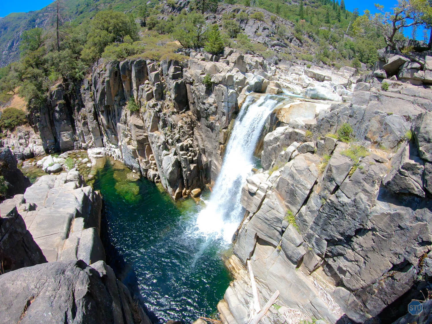
The Palisades Creek Trail is the most accessible gateway to the spectacular 4,000 foot-deep canyon commonly known as Royal Gorge.
This gorge begins where the North Fork American River merges with a number of creeks (Cedar, Onion, and Serena) just below Soda Springs Road, continues west in view of the impressive Snow Mountain (8,023 ft), the river then wraps around Snow Mountain, and the gorge ends where the North Fork merges with Granite Creek on the opposite side.
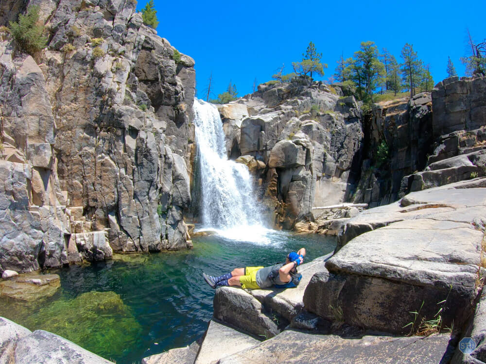
The Royal Gorge is a 13 mile section of river that descends more than 2,500 ft. The resulting landscape is difficult to traverse but spectacular to behold: polished granite gorges, deep fascinating chasms, beautiful waterfalls, and clear emerald pools are just a few of the rewards one can see in the Royal Gorge.
Miles
Vert. Ft.
Avg. Elev.
Route Details
Trail Awesomeness: Granite gorges, beautiful waterfalls, and clear emerald pools are just a few of the rewards one can see in the Royal Gorge, at the end of Palisades Creek Trail.
Route Type: Out-n-back. No connector trails for loops available.
Trail Type: single track. Lots of switchbacks.
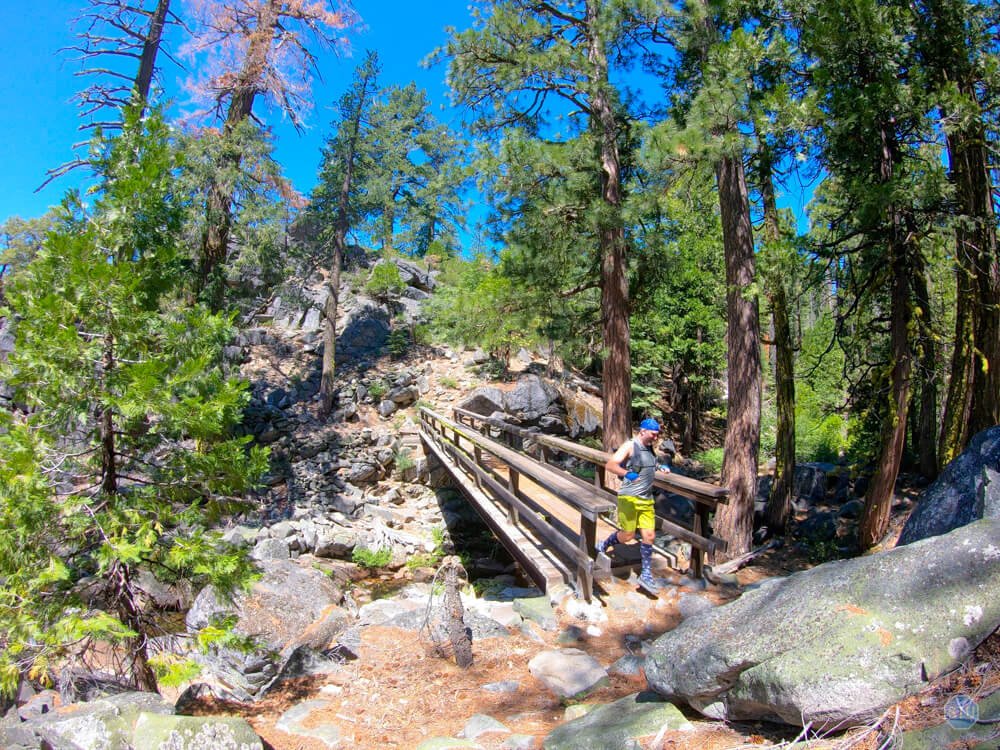
Trail Condition: clearly marked. Easy to follow. A dozen downed trees across the trail but easy to get around them. Two bridges allow easy crossing of Palisades Creek and the North Fork American River.
Trail Traffic: Moderate. Busiest between 10AM to 4pm, especially on weekends.
Trail Systems/Areas: Palisades Creek Trail and Royal Gorge
Water Sources: several springs, creeks, and lakes along route.
Bug Conditions: lots of mosquitos, gnats, and horse flies after Devil’s Peak when trail drops in elevation. Worse along the Palisades Creek section. Worst during the wet season.
Weather Report: Norden, CA and Kingvale, CA
Start Location: Palisades Creek Trailhead
Finish Location: Bridge marks where Palisades Creek merges with the North Fork American River (7 mi) and Palisades Creek Trailhead (14 mi)
Fees/Permits: Currently, no fees required with lots of parking available.
Potable Water: no
Bathrooms: no
Cell Reception: partial at Trailhead. None past Devil’s Peak.
Historical Significance: the Royal Gorge has been closed off to the public for a number of years due to the fact that many of the surrounding properties are privately owned and greatly limited its accessibility to the general public. However, the Palisades Creek Trail is open to the public, accessible, and the easiest way to access the Royal Gorge.
Natural Significance: the Royal Gorge is a 13 mile section of river that descends more than 2,500 ft. The resulting landscape is difficult to traverse but spectacular to behold: polished granite gorges, deep fascinating chasms, beautiful waterfalls, and clear emerald pools are just a few of the rewards one can see in the Royal Gorge.
ATTENTION!!
NO CELL RECEPTION: The Palisades Creek Trail is 7 miles and drops more than 3,000 feet into the Canyon. There is no cell reception.
NO EASY ACCESS: There are no other access points. Once in the Gorge, there is only one way out—there are no other trails. The off-trail terrain is very steep with lots of loose rock and thick vegetation. DO NOT explore off the Palisades Creek Trail without proper gear, support, experience, and expertise—it’s very dangerous!
TRAIL CLOSURE: The TRAIL will be CLOSED from AUGUST THRU OCTOBER (2022) due to construction on the Cascade Lake Dam, which the trail uses to cross between Cascade Lakes.
Route Guide
0.00 mi ⇒ Palisades Creek Trailhead between Cascade Lakes (START) | Cross the dam between Cascade Lakes. Sign on the opposite side. Follow PAlisade Creek Trailhead.
0.35 mi ⇒ Trail Junction & Palisades Creek Trail | Take the Left trail. Right trail goes to Long Lake.
2.25 mi ⇒ 1st Thick Vegetation Section | This section is ¼ mile, downhill, and has a couple downed trees in the middle.
3.00 mi ⇒ 2nd Thick Vegetation Section & No Name Lake #3 | This section is about 1/8th of a mile and runs along a small lake with no name. Good spot for water if all the creeks are dried up.
5.50 mi ⇒ Bridge Crossing & Palisades Creek & Vista | Follow the main trail across the bridge. Follow around a small bald granite hill on the opposite side of the bridge to where the hill is less steep. On top is a great view to the North Fork American River, Snow Mountain, and the Foresthill Divide.
6.25 mi ⇒ View of Hidden Falls along Palisades Creek | Venture off the trail a ¼ mi due west to an exposed granite rock. There is an overlook revealing a waterfall dropping nearly 100 feet just after where Long Valley creek joines Palisades Creek. Further down the trail approx ¼ mi, there is another spot through some trees where the waterfall is partially visible.
7.00 mi ⇒ Bridge Crossing & Palisades Chutes along N. Fork American River (FINISH) |
7.00 mi ⇒ Palisades Creek merges with North Fork American River | When the Palisades Creek is full, it forms a wide block-style waterfall that drops 10 ft into the North Fork American River.
7.25 mi ⇒ Palisades Falls (aka: Rattlesnake Falls) | THIS waterfall is sometimes called Rattlesnake Falls because of the way it drops halfway, coils into a pool, and drops the second half into a deeper pool and gorge.



Resources
- Closest Town: Truckee, CA (15mi/20mins) (Google Maps)
- Nearest Gas: Donner Summit Gas (8mi/10mins) (Google Maps)
- Nearest Restaurants: several venues in Truckee, CA (15mi/20mins) (Google Maps)
- Nearest Ranger Station: Truckee Ranger District (Google Maps)
- Good intel and images on Ropewiki and Flyminion-LiveJournal
- Weather updates for Norden, CA and Truckee, CA
Post-Adventure EATS & BREWS
STOPSTU’s choices for EATS & BREWS near Palisades Creek Trail, CA.
“FiftyFifty has a really great menu of Burgers, sandwiches, and more!” -Stu
PIZZA:
“Zano’s is my favorite when I’m hungry.” -Stu
SANDWICH:
“I just love this place! Their food is so delicious and so filling!” -Stu
BURGER:
“Burger Me is so good! Not just great Hamburgers, but some of the best Garlic Fries I’ve ever scarfed down!” -Stu
BBQ:
“The Bar Burrito with Brisket still makes me taste buds jump out of my mouth!” -Stu
CHINESE:
“Wong’s has decent food.” -Stu
MEXICAN:
“Tacos Herrrera has GREAT street tacos! And Taco’s Jalisco has great burritos!” -Stu
BREAKFAST:
“Wild Cherries has good breakfast sandwiches and pastries! Full Belly Deli has the BEST breakfast burritos! The Gnar is spectacular!” -Stu
COFFEE:
“If I just want coffee, I’ll go to Dark Horse. If I need food, Wild Cherries is my first choice, and CoffeeBar a close second.” -Stu
HEALTHY:
“I visit this place for a T-Rex shot whenever I get a Gnar Burrito at Full Belly Deli next door” -Stu
HONORABLE MENTIONS:
More Photos






0 Comments